
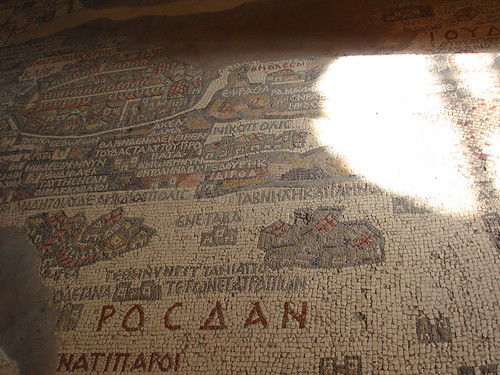
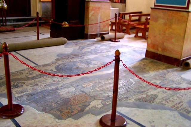
The Madaba Map is the oldest extant map of the Holy Land and is dated to the middle of the 6th century AD. It was discovered in the 19th century, during an excavation and reconstruction of a mosaic floor in St George’s Church in Madaba, Jordan. The mosaic map was created according to the Old and New Testaments by Greek monk Salmanos. The map represents biblical sites: Jordan river and mount Nebo in Jordan; Jerusalem, Bethlehem, Jericho – on the Western bank of Jordan River in Palestine and Israel, Delta Nile and Sinai desert in Egypt.
Jerusalem is the biggest city on the
map. The map depicts some famous Old City structures such as the Damascus Gate,
St. Steven’s Gate, the Golden Gate, the gate leading to Mount Zion, the Citadel
(Tower of David), the Church of the Holy Sepulchre, and the Cardo Maximus.
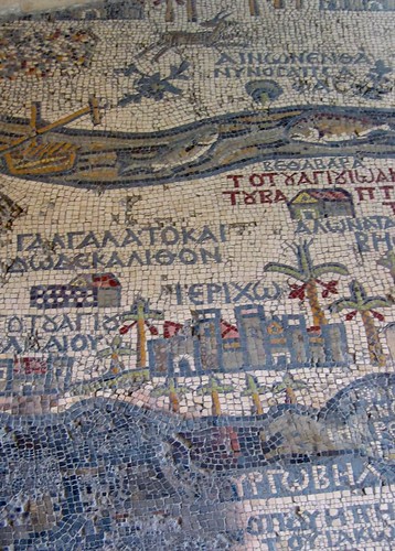
Mosaic map. Jordan river and Jericho city
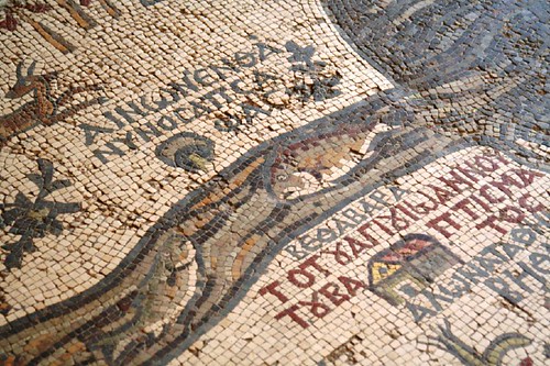
Mosaic map. Aynon, Baptism site
The mosaic Map of Madaba was
discovered in 1896 by chance. This discovery drew the city to the attention of
scholars worldwide. Nowadays, Saint George’s Church became one of the
most visited tourist sites in Jordan. Pilgrims from all around the world come
to Madaba to see the original mosaic floor.
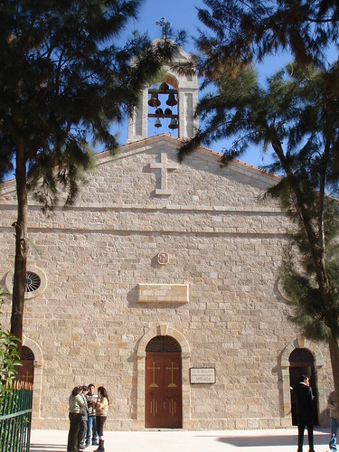
Greek - Orthodox St. George's Church is active and used for church services. During the service the mosaic map is covered by carpet.
0 comments:
Post a Comment